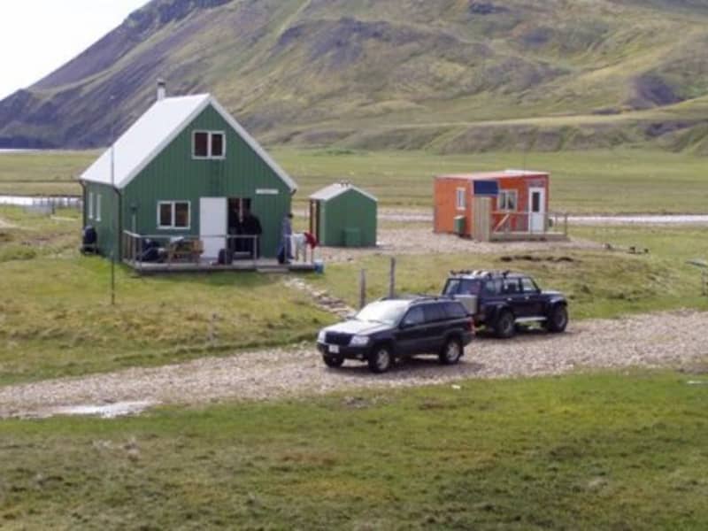
GPS: N64°58 W19°14
Mountainhuts & Cabins
78 niðurstöður

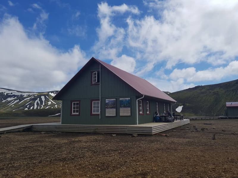
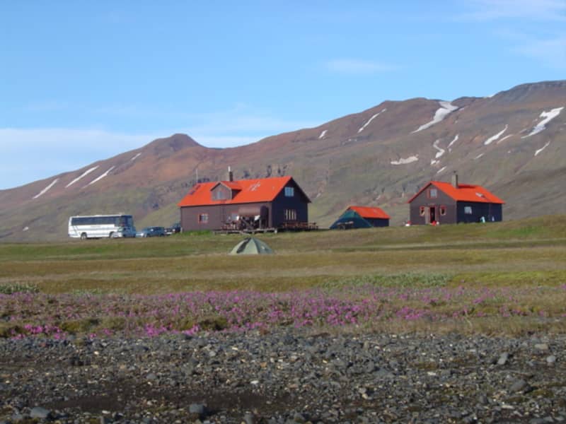
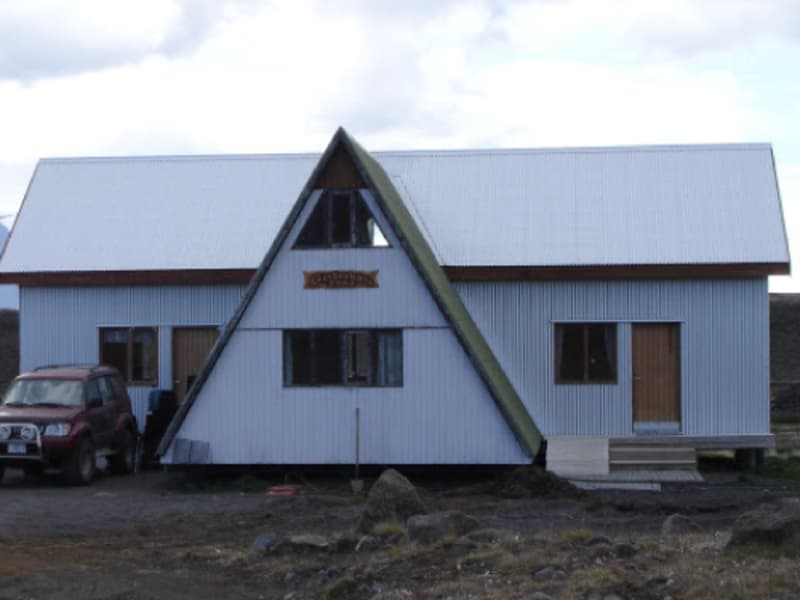
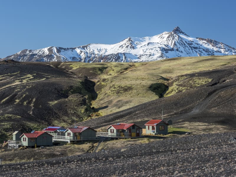
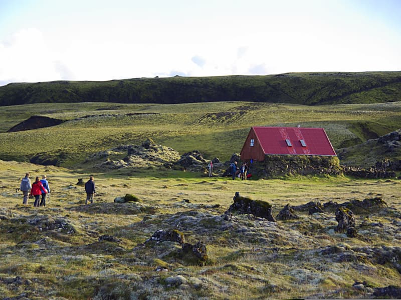
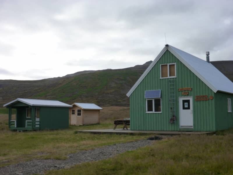
Hrafntinnusker - Iceland Touring Association
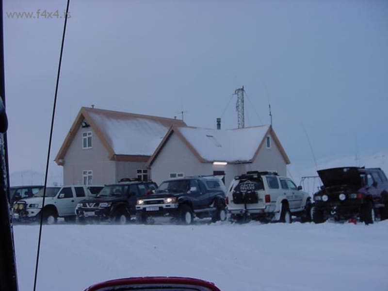
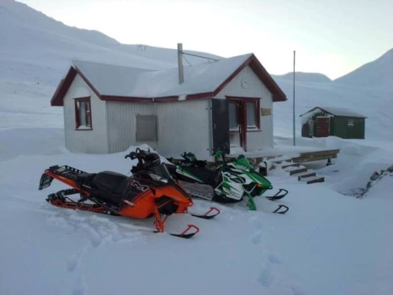
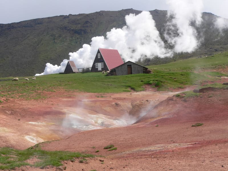
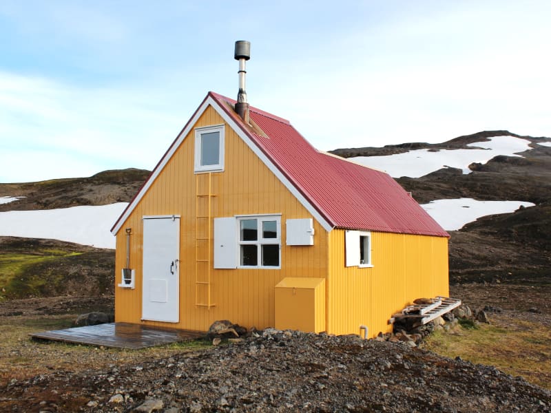
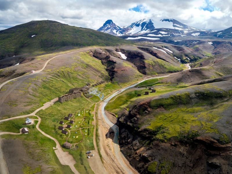
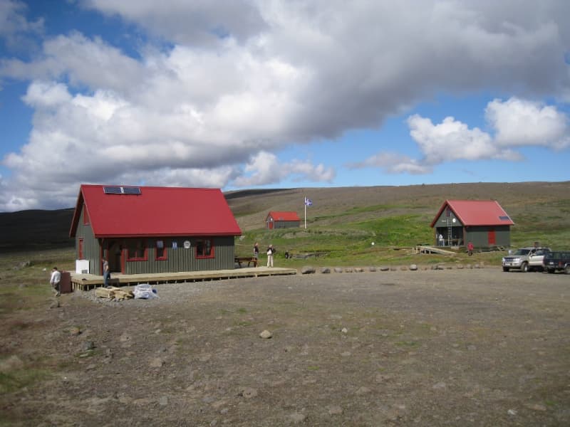
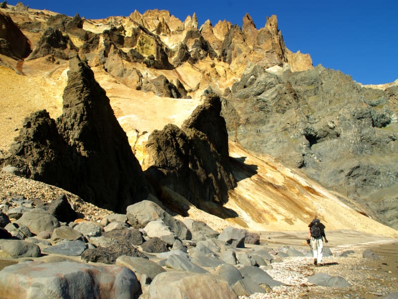
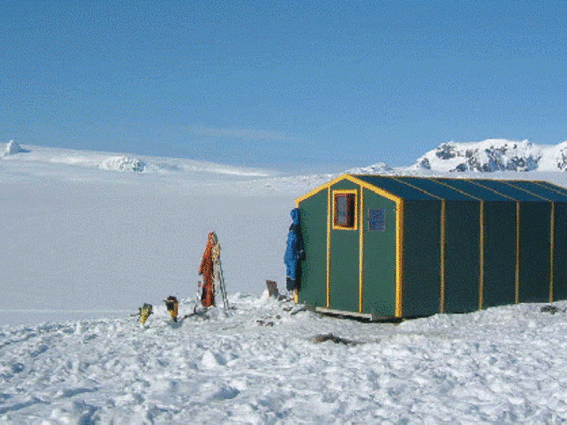
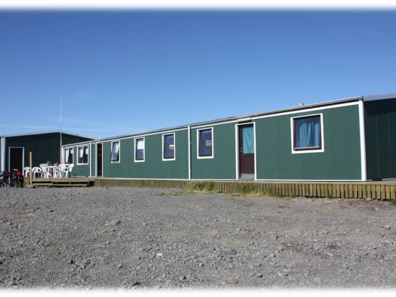
Mörkin 6, 108 Reykjavík,The hut in Hrafntinnusker on the Laugavegur trail accommodates 52 people in sleeping bags. It is equipped with gas stoves, utensils and running water. Dry toilets are connected to the hut but not accessible from inside. Camping is on sand, gravel and snow and can be challenging due to extreme weather conditions. Campers have access to a shelter for cooking.
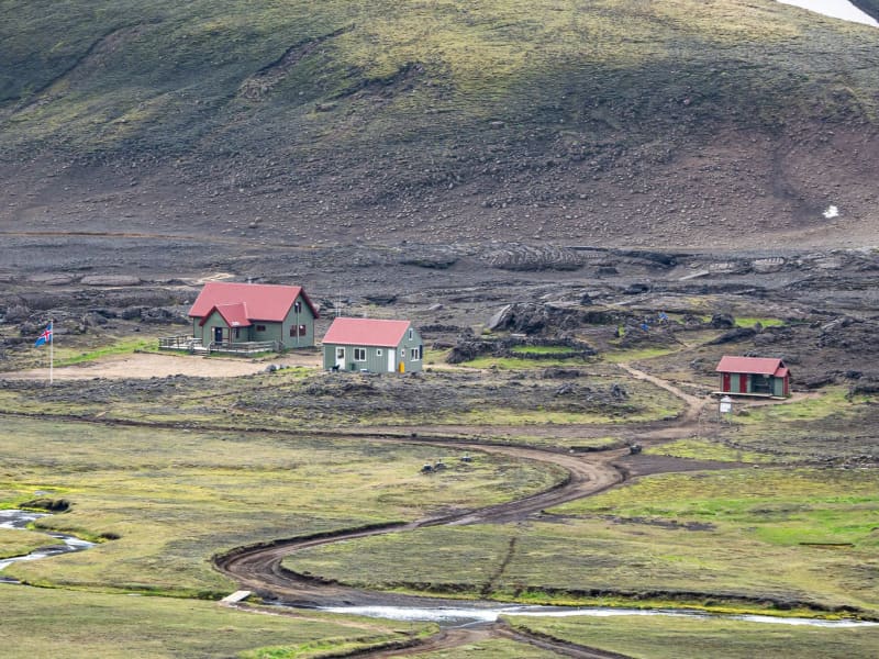
Hvítárnes - Iceland Touring Association
Mörkin 6, 108 Reykjavík,The hut in Hvítárnes accommodates 30 people in sleeping bags. It is equipped with gas stoves, utensils and running water. There are bathrooms in a building nearby. The campground is located near the bathroom building.
Botni - Ferðafél. Akureyrar/ITA
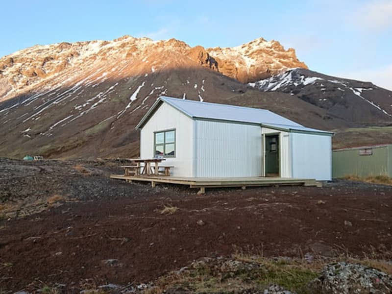
Strandgata 23, 600 Akureyri ,Botni hut is located approx. 650 m SSE from the uppermost origin of Suðurá river, near the NW edge of Ódáðahraun lava field. The hut was built in 1996 and sleeps 16. The hut has a kerosene-operated stove for heating and gas cooker for cooking. Drinking water can be obtained from wells some 200 m S of the hut or from the uppermost tributaries of Suðurá river. The hut remains open all year round. There is a walking route from Dyngjufell hut to Botni (20-22 km) and from Botni to Svartákot farm (15-16 km).
GPS: N65°16,18 W17°04,10
Primitive facilities.
Reservations and enquiries: Club office of FFA: e-mail: ffa@ffa.is or phone number: +354 462 2720.
See website: https://www.ffa.is/en/huts/huts
Álftavatn - Icelandic Touring Association
Álftavatni, 851 Hella,The huts in Álftavatn on the Laugavegur trail accommodate 72 people in sleeping bags. They are equipped with gas stoves, utensils and running water. There are bathrooms and showers in a nearby building. The campground is further towards the lake.
Fimmvörðuháls - Útivist Touring Club
Office: Laugavegur 178, 105 Reykjavík ,GPS: : N 63°37,320 / V 19°27,093
Between Mýrdalsjökull glacier and Eyjafjallajökull glacier. Gas for cooking, primitive facilities. Open from mid-June and through August.
Snæfell
701 Egilsstaðir (dreifbýli), 701 EgilsstaðirThe hut by Snæfell has sleeping bag accommodation for 45 people and a living area for about 30 people. GPS location
for the hut is: 64.48.250N/ 15.38.600V. In the summer there is running water and a WC but during winter there is a composting toilet. The campsite is located close to the hut and to get there you need to drive road F909. There are many different hiking trails in the area, both marked and unmarked, and the hut lies about 1 km from the walking path to the top of Snæfell.
All opening dates can change due to weather conditions.
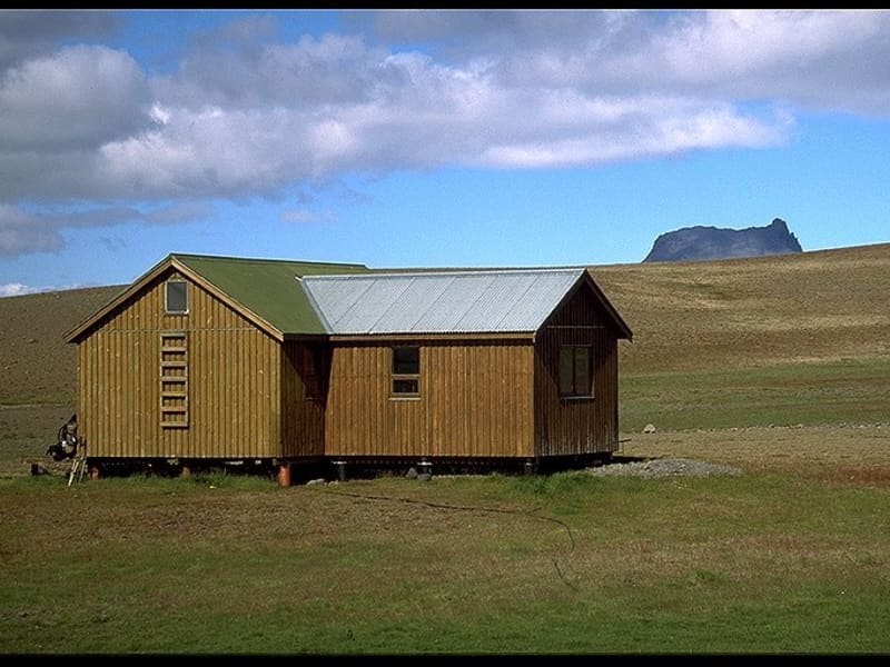
Nýidalur - Iceland Touring Association
Mörkin 6, 108 Reykjavík ,The huts in Nýidalur accommodate 54 people in sleeping bags. They are equipped with gas stoves, utensils and running water. There are bathrooms and showers in a nearby building. The campground is near the bathroom building.
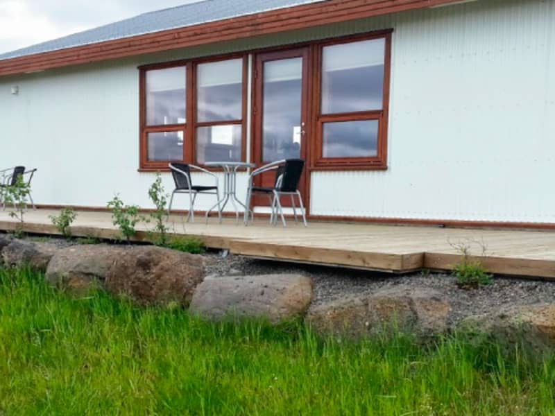
Hólaskógur Mountain Lodge
Hólaskógi 1 - v/veg 32, 804 SelfossHólaskógur is a destination for larger groups, whether they travel on foot, on horses or other vehicles. The Lodge accommodates 40 people in sleeping bags. Each floor can accommodate 20-24 people. There is a fully equipped kitchen on each floor that guests have shared access to, along with toilet facilities. There are also facilities for horses and hay for sale.

Sveinstindur - Útivist Touring Club
Office: Laugavegur 178, 105 Reykjavík ,GPS: N64°05,176 W18°24,946 By Langisjór.
WC and gas for cooking.
Ferðafélag Fljótsdalshéraðs - Loðmundarfjörður-Klyppstaður
Víknaslóðir, 720 Borgarfjörður eystriThe chalet of the Fljótsdalshérað Touring Club at Klyppsstaður in deserted fjord Loðmundarfjörður has a sleeping bag accommodation for up to 38 people. This is a spacious chalet, situated along the celebrated Víkurslóðir hiking route.
. Accommodation: 38 sleeping bag
. Operating time: Closed and locked during winter, wardens during summer
. GPS: N°65.21.909-W13°53.787
. Other facilities: Wood stove for heating, gas stove for cooking, extra kitchen tent, shower and toilet, drying room,
charging for telephones and cameras, coal grill and camping place.
Ferðafélag Fljótsdalshéraðs - Egilssel at Kollumúlavatn
Egilssel,Accommodation: 20 sleeping bags
. Telephone: No telephone
. GPS: N64°36.680 - W15°08.780
. Other facilities: Wood stove for heating. Gas stove for cooking. Dry toilet. Camping place.
. Notice: The hut is locked the whole year. There is a key box and people need to contact the office for key numbers. Telephone 354-863 5813
Mosar-Reykjaheiði Mountain Hut
Brimnes, 620 DalvíkPlease contact for prices and booking information.
Baugasel - Ferðafélagið Hörgur/ITA
Baugasel, 604 AkureyriBaugasel is is an old turf house in Barkárdalur, a deserted valley that stretches west from Hörgárdal into the middle of the Troll Peninsula. The valley is surrounded by high mountains and people did not see the sun in Baugasel from October 4th to March 8th or for 157 days. Hörgur Travel Club renovated the old turf house as a hiking lodge in the 1980s. A jeep trail leads from the main road to Baugaseli, which is about 7 km.
Small Cabin Myrkholt
Myrkholt, 806 SelfossAccommodation for 8 people
This cabin is smaller or about 70 m2 and has 3 bedrooms. One bedroom has a twin bed and the other two bedrooms are for three people. It can be rented with or without bed linen. A spacious bathroom, kitchen and dining room with WI-FI.
The view from the cabin is over the geothermal area of Geysir and you can see the world famous Strokkur erupt from the cabin.
Múlaskáli
Lónsöræfi, 780 Höfn í HornafirðiGPS: N64°33,200 W15°09,077
Gas, shower, wc. Organized tours with guide for groups.
Lambi - Ferðafél. Akureyrar/ITA
Strandgata 23, 600 AkureyriGPS: N65°34,88 W18°17,77
Lambi hut is located in Glerárdalur valley, SW from the Akureyri town, approx. 720 m above sea level. The hut was built in 2014 and sleeps 16. The hut has a kerosene-operated stove for cooking and for the heating of the hut. Drinking water can be obtained from a small stream approx. 100 m S from the hut.
There is a marked walking route, 10-11 km, from a car park at the rubbish tip of Akureyri town to the hut. There is a great variety of interesting mountain routes in the Glerárdalur area, starting from the hut, see the walking route map of Glerárdalur.
Reservations and enquiries: Club office of FFA: e-mail: ffa@ffa.is or phone number: +354 462 2720.
See website: https://www.ffa.is/en/huts/huts
Hlöðuvellir - Iceland Touring Association
Mörkin 6, 108 Reykjavík,The hut at the foot of Mt. Hlöðufell accommodates 15 people in sleeping bags. The hut is equipped with a gas stove and basic utensils. There is no running water in the hut. There is an outhouse near the hut with no running water.
Hólaskjól-Higlandcenter
Flaga, 881 KirkjubæjarklausturHólaskjól is located on the highland route, Fjallabaksleið Nyrðri, about 35 km. from the main # 1 road. You pass through the Skaftártunga area, road # 208, onto the Fjallabaksleið Nyrðri, road # F208. This is a coarse gravel road, but in summer it is passable by all types of vehicles. There are no unbridged rivers on the way.
From Hólaskjól it is about 6 km. to the Eldgjá canyon. Shortly before you reach Eldgjá there is a small unbridged river, that quite often can only be forded by 4X4 vehicles.
Hólaskjól is located at the foot of Lambaskarðshólar hills, at the edge of a lava field originating from an eruption in Eldgjá during the years 934-940. Hólaskjól is in a peaceful, sheltered area with beautiful surroundings. Only a 5 minute walk away is a very impressive waterfall in the river Syðri Ófæra. Itt resembles a smaller version of the well-known Gullfoss, or Golden Falls, and is therefore often called Little Gullfoss or Silver Falls.
At Hólaskjól there is the main lodge on two floors, with sleeping bag accommodations in bunks for 61 persons. There are WC´s and showers on both floors and also cooking facilities with gas stoves and utensils for cooking and eating.
There are also a few huts that are possible to rent with or without bed linen. The huts have gas stoves, utensils for cooking and eating, WC, and cold running water.
There is good space available for tents and campers. The campsite has tables and chairs, toilets and showers.
- Sleeping bag in a hut
- Cottages with WC, kitchen, and showers (bunker beds for 4):
- Camping
- Cabin by Langisjór, incl. fishing permit:
- Sleeping bag accommodation, bunker bed for 4 plus a sofabed for 2
- Fishing permit in Langisjór
Gps unit: 64° 7,144'N, 18° 25,689'W (ISN93: 527.862, 401.918)
Heilagsdalur - Ferðafélag Húsavíkur
Heilagsdalur, 640 HúsavíkHeilagsdalur is a mountain hut that can accommodate 18 people. For further information please contact the representitives at Ferðafélag Húsavíkur.
Gislaskali
Svartárbotnum, 806 SelfossThe cabin has sleeping-bag accommodation for 45-50 overnight guests in 6 rooms. Guests have the use of excellent cooking facilities and a spacious and comfortable dining area, two sitting rooms, WC and hot showers. The cabin has electricity for light and heating.
Good facilities for horses in a big stable with a corral. Hay sold for horses.
Gíslaskáli is situated in beautiful surroundings in an untouched area of the lava field Kjalhraun right beside the source of Svartá. Svartá is the biggest spring fed river in the area and slowly grows bigger from small springs along the edge of the lava. It is a beautiful hike along the river to the cabin Árbúðir 20 km to the south.
Due west from Gíslaskáli is Kjallfell, an easy climb that gives excellent views in all directions.
A path leads north through the lava to Beinhóll (Bone hill) where a monument can be found that commemorates the ill-fated expedition of the two brothers from Reynistaður in northern . They died in a terrible snow-storm when they were taking sheep across the highland in November 1780. This story has fascinated Icelanders through the centuries and led to many ghost stories.
A few km to the east is the glacier river Jökulfall. The river runs in a deep canyon and many small waterfalls. A marked walking path can be found along the river.
Hveravellir and Kerlingafjöll hot-spring areas are within easy reach by car.
Gíslaskáli offers first rate facilities for tourists travelling across the highlands. Enjoy Icelandic nature at its best away from the crowds.
Skælingar - Útivist Touring Club
Office: Laugavegur 178, 105 Reykjavík ,GPS: N 63°58,849 / V 18°31,319
At Eldgjá. WC but no kitchen.
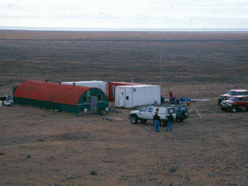
Dyngjufell - Ferðafél. Akureyrar/ITA
Strandgata 23, 600 Akureyri ,Dyngjufell hut is located in Dyngjufjalladalur valley, NW of the Dyngjufjöll massif. The hut was built in 1993 and sleeps 16. The hut has a kerosene-operated stove for the heating of the hut and gas cooker for cooking. Drinking water can often be obtained from a small stream which flows N through the valley. The hut remains open all year round. There is a walking route from Dreki hut across the Askja caldera and Dyngjufjöll massif to Dyngjufell hut and from there N to the Botni hut by Suðurárbotnar wells.
GPS: N65°07,48 W16°55,28
Primitive facilities.
Reservations and enquiries: Club office of FFA: e-mail: ffa@ffa.is or phone number: +354 462 2720.
See website: https://www.ffa.is/en/huts/huts
Emstrur - Iceland Touring Association
Mörkin 6, 108 Reykjavík,The huts in Emstrur on the Laugavegur trail accommodate 60 people in sleeping bags. They are equipped with gas stoves, utensils and running water. There are bathrooms and showers in a nearby building. The campground is in a small valley below. Campers have access to a shelter for cooking.
Breiðá - The Iceland Glaciological Society
125 Reykjavík,GPS: N64°2,328 W16°18,514
On Breiðamerkursandur, South-Iceland.
Dreki - Ferðafél. Akureyrar/ITA
Strandgata 23, 600 Akureyri ,Dreki hut is located at the mouth of the Drekagil gorge, just under the E side of the Dyngjufjöll massif. The hut can be reached by mountain road F88 from the ring road east of lakeMyvatnor by mountain road F910. There are two residential huts on the site which sleep a total of 55. The huts have kerosene-operated stoves for the heating of the huts and gas for cooking. There is a sanitary house with WC and shower facilities by the hut, open during the summer months while the hut wardens are in the area. There is a camping site by the hut. The huts are open from approx. 20 June 5 Sept. There is a marked walking trail from the hut W across Dyngjufjöll massif into the Askja caldera and also N to Bræðrafell hut. The Drekagil area is an ideal base for those who wish to explore the Askja caldera (9 km by car).
GPS: N65°02,52 W16°35,72
East of Dyngjufjöll mountains. Water, wc.
Reservations and enquiries: Club office of FFA: e-mail: ffa@ffa.is or phone number: +354 462 2720.
See website: https://www.ffa.is/en/huts/huts
Vakinn
Iceland Touring Association
Mörkin 6, 108 ReykjavíkPlease contact for tours and booking information.
Þórsmörk - Iceland Touring Association
Mörkin 6, 108 Reykjavík ,The hut in Langidalur in Þórsmörk, at the end of the Laugavegur trail, accommodates 75 people in sleeping bags. It is equipped with gas stoves, utensils, and running water. There are bathrooms and showers in a nearby building. The campground is located all around the hut area. Campers have access to a shelter for cooking.
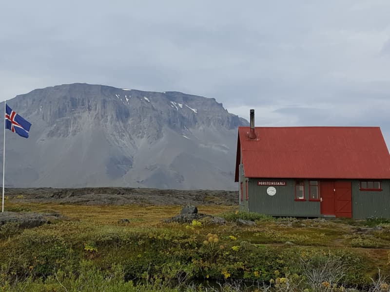
Þorsteinsskáli - Akureyri Touring Association
Strandgata 23, 600 Akureyri,Thorsteinsskáli hut is located in the Herðubreiðarlindir oasis, approx. 4 km E of the beautiful Herðubreið table mountain. The hut was built in 1958-60 and sleeps 30. It has gas for cooking and kerosene stove for heating. There is a sanitary house with WC and a gas-operated shower, open during the summer months, when there are hut wardens in the area. There is a camping ground by the hut. The hut is closed during the winter months. The mountain road F88 from the ring road W of Jökulsá á Fjöllum river to the Askja caldera passes close by.
GPS: N65°11,56 W16°13,39
Herðubreiðarlindir. Heating, gas for cooking, WC.
Reservations and enquiries: Club office of FFA: e-mail: ffa@ffa.is or phone number: +354 462 2720.
See website: https://www.ffa.is/en/huts/huts
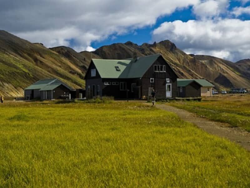
Landmannalaugar - Iceland Touring Association
Mörkin 6, 108 Reykjavík ,The hut in Landmannalaugar, at one end of the Laugavegur trail, accommodates 78 people in sleeping bags. It is equipped with gas stoves, utensils and running water. There are bathrooms and showers in a nearby building. The campground is near the hut area. Campers have access to a shelter for cooking.

Hof - Ferðafélag Húsavíkur
Hof, 640 HúsavíkHof in Flateyjardalur is a mountain hut that can accommodate 25 people. For further information please contact the representitives at Ferðafélag Húsavíkur.
Þeistareykir Mountain Hut
Þeistareykir, 640 HúsavíkÞeistareikir, the highland hut of 4×4 club in Húsavík.
The hut was built in 1958 and is managed by the Húsavík division of F4x4. The hut is located under Bæjarfjall, west of Þeistareykjarbunga and is can accommodate 30 people, of which 18 are in bunk beds.
To gain access to the mountain hut, you must contact Ómar Egilsson, tel. 866 4083
Big Cabin Myrkholt
Skálinn, Myrkholt, 806 SelfossAccommodation for 32 people
It’s located in Myrkholt, between Gullfoss waterfall and Geysir area. It’s a new cabin and has 8 rooms for 4 people. You will find a fully equipped kitchen, toilet- and bath facility, dining room and living room.
Myrkholt is also a horse rental and has facilities for the horses, both a paddock and a stable. We offer riding tours from 1 hour tours up to day tours. Nearby the cabin you will find beautiful hiking trails and horse paths which take you the waterfall Gullfoss, the geothermal area Geysir, the canyons where the glacier river Hvítá runs and around the forest Haukadalsskógur. The cabin offers a picturesque view as it’s situated so closely to the isolated highlands, an ideal place to breathe in the mountain air in your pajamas.
Kverkfjöll - The Iceland Glaciological Society
125 Reykjavík ,GPS: N64°40,350 W16°41,385
Kverkfjöll (1977) 6 people
Ferðafélag Fljótsdalshéraðs - Geldingafell
Geldingafell,Accommodation: 16 sleeping bags
. Telephone: No telephone
. GPS: N64°41.711-W15°21.681
. Other facilities: Wood stove for heating. Gas stove for cooking. Dry toilet. Camping place.
. Notice: The hut is locked the whole year. There is a key box and people need to contact the office for key numbers. Telephone 354-863 5813
Fremstaver
Myrkholti, Bláskógabyggð 801 Selfoss ,Fremstaver is a cozy hut on the south slopes of the mountain Bláfell. A track off the main road leads there. The cabin has sleeping-bag accommodation for 25 overnight guests. Guests have the use of good cooking facilities and WC. The cabin is situated in beautiful surroundings that offer many sight-seeing possibilities. Climbing the mountain Bláfell is a long but rewarding walk. The top offers views vide and far on a good day. Maybe it’s possible to get lucky and find the cave of the giant Bergþór who left a treasure there for the worthy to find. Another excursion is to the great canyon Kór.
25 km from Geysir. WC.
Bræðrafell - Ferðafél. Akureyrar/ITA
Strandgata 23, 600 Akureyri,Bræðrafell hut is located SA from the Bræðrafell mountain, just S of the Kollóttadyngja lava shield. The hut was built in 1976-77. The hut sleeps 16 and has a coal-operated stove for cooking and for the heating of the hut. Drinking water is collected from the roof into reservoirs on the sidewalls of the hut. The hut remains open all year round. There is a walking route from the Herðubreið mountain W to the hut, approx. 9-10 km, marked by yellow sticks.
The marked walking GPS: N65°11,31 W16°32,29
Primitive facilities.g route continues S to Dreki hut, E of the Dyngjufjöll massif.
Reservations and enquiries: Club office of FFA: e-mail: ffa@ffa.is or phone number: +354 462 2720.
See website: https://www.ffa.is/en/huts/huts
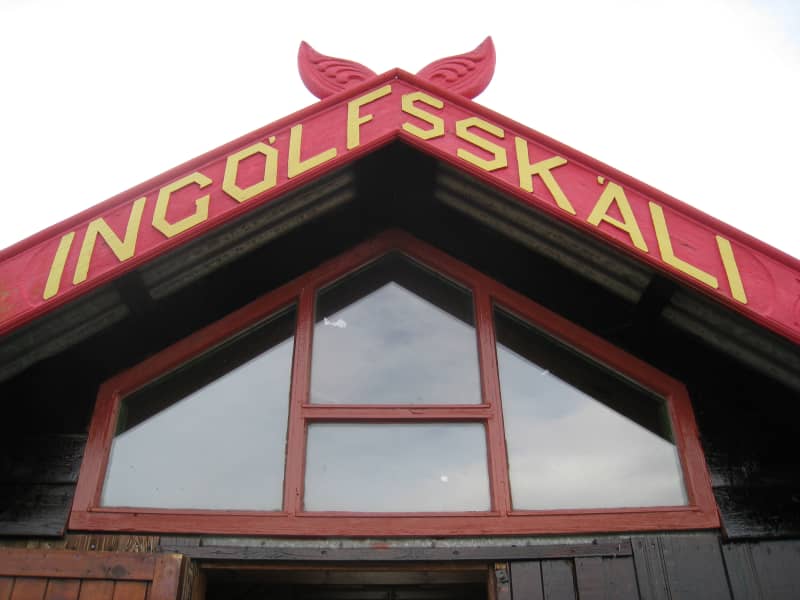
Ingólfsskáli - Skagafjörður Touring Club
550 Sauðárkrókur ,GPS: N65°00,470 W18°53,790
No water, primitive facilities.
Kerlingarfjöll – Highland Base
F347, 845 FlúðirHighland Base was conceived as the staging ground for epic adventures deep in the highlands of central Iceland. A year-round oasis of warmth and comfort, this remote outpost accommodates all levels of hospitality. With a campground, hostel huts, dormitory beds, upscale rooms, luxury suites, private lodges, thermal baths, and a cozy restaurant, Highland Base is a first-of-its-kind highland resort.
Located at the edge of the majestic Kerlingarfjöll mountain range, the destination is a thrillseeker’s paradise, offering a vast array of guided and unguided adventures. While the experiences are seasonal, the excitement is timeless. In summer, hiking and mountain biking bring you face-to-face with the mountainscape's geothermal valleys and breathtaking panoramas. In winter, cross-country skiing, backcountry skiing, and snowmobiling set you free to explore the untamed wilderness. And when you return to Highland Base from a day of adventuring, you'll always find a warm and welcoming refuge—a place to relax, reflect, and recharge.
Volcano Huts Þórsmörk
Húsadalur Þórsmörk via Road no. F 249 ,Volcano Huts Þórsmörk
Volcano Huts are located in the Þórsmörk nature reserve in Iceland, situated in the Húsadalur valley, between towering glaciers and volcanoes. The area can best be described as a hiker's paradise where you will find endless hiking trails that lead you through beautiful, volcanic landscapes. Here you will experience Icelandic nature at its best and meet interesting people that share your passion for nature and adventure.
Accommodation and other services can be booked through our website www.volcanotrails.com
Services at the Volcano Huts
Accommodation: Volcano Huts of fer accommodation in small cottages, shared mountain hut dormitories, private bedrooms, glamorous glamping tents and camping grounds surrounded by unique volcanic nature.
Restaurant : The LavaGrill is the heart of the Volcano Huts and offers rich and hearty meals made from local Icelandic ingredients. We offer breakfast, lunch and dinner, cakes and coffee. We can also send you off with a packed lunch. The bar offers a selection of local beers and other drinks.
Things to do: Most people come for the endless hiking trails in and around Thorsmork , while others come for a short stop and a meal at the LavaGrill. We offer access to a natural shallow pool and sauna, which are included in the accommodation. We have something for all ages, so everyone should find something to do.
Hiking trails: Some people choose to go on shorter walks and return to Volcano Huts in the afternoon, while others may venture deeper into the mountains on their way along the Laugavegur hiking trail, which connects Thorsmörk and the Landmannalaugar area or perhaps hiking in between two glaciers while hiking the Fimmvörðurháls trail.
How to get here: The best way to g et here is by bus, as you will have to cross big rivers on the way. You can take the bus from Reykjavik or at one of the several designated bus stops on Road1. Further information on how to get here is available on our website.
For further information and bookings, please visit our website www.volcanotrails.com , send us an email info@volcanotrails.is or call us on +354 419 4000.
Glamping single/double - 16
rooms - single / double - 14
cottages - for 4 pers. - 8
Cabin dorms - 34 beds
Camping 100 +
Laugarfell
Fljótdalsheiði, 701 EgilsstaðirLaugarfell is located in the eastern part of the Icelandic Highlands, a bit north from Mount Snæfell. There are only two km.from the road that leads to Kárahnjúkar to Laugarfell and it is the only part of the road that is not paved. In the summer there is good access to Laugarfell in all kinds of vehicles.
Laugarfell offers accommodation for 28 people. Two natural pools are located in Laugarfell and according to old folk tales the water is known for its healing powers.
There are many interesting tracking paths around Laugarfell and a number of beautiful waterfalls. Additionally, one can expect to see reindeer wandering around the area of Laugarfell.
Laugarfell is open from the 1st of June to 30 of September.
We open by agreement during the winter time.
Þjófadalir - Iceland Touring Association
Mörkin 6, 108 Reykjavík ,The small hut in Þjófadalir accommodates 12 people in sleeping bags at most. It is equipped with a small gas stove and basic utensils. There is no running water. There is a small outhouse near the hut with no running water. The camping is around the hut.
Laugafell - Ferðafél. Akureyrar/ITA
Strandgata 23, 600 Akureyri ,Laugafell hut is located on the high plateau of North Icleand, 15 km NE of Hofsjökull glacier and 20 km SW from the end of Eyjafjarðardalur valley. The old hut was built in 1948-50 and the sanitary house with sleeping accommodation was built in 1994-98. The accommodation in the huts is a sleeping bag accommodation.
Guests must bring their own sleeping bags. The old hut sleeps 20 and the sleeping loft in the sanitary house sleeps 12. The houses are heated all year round with geothermally hot water. There is gas for cooking. The sanitary house
has WC facilities and changing cubicles for the adjacent swimming pool. The camping place is beside the huts. There is a warden at Laugafell in July, August and the beginning of September. The huts are locked in the winter but the toilets and changing facilities are open all year round. The Laugafell area is conveniently located for 4-wheel drive traffic on the northern high ground of Iceland as tracks lead from Laugafell to Eyjafjörður (F821), Skagafjörður (F752), Bárðardalur (F881 and F26) and the South via Sprengisandur (F752 and (F26).
Phone number (in summer): (+354-) 833-5697.
Reservations and enquiries: Club office of FFA: e-mail: ffa@ffa.is or phone number: +354 462 2720.
See website: https://www.ffa.is/en/huts/huts
GPS: N65°01,63 W18°19,95
Heating, gas for cooking, wc.
Ferðafélag Fljótsdalshéraðs - Sigurðarskáli
Kverkfjöll,. Accommodation: 75 sleeping bags
. Operating time: Closed and locked during winter, wardens during summer
. Telephone: 863 9236
. GPS: N64°44.850-W16°37.890.
Other facilities: Oil stove for heating. Gas stove for cooking. Toilets and showers. Camping place.
Norðurfjörður - Iceland Touring Association
Valgeirsstaðir, 524 ÁrneshreppurValgeirsstaðir in Norðurfjörður is an old farm that accommodates 24 people. It is equipped with stoves, utensils and running water. There is a bathroom in the building. The campground is outside the building. Campers have access to a shelter for cooking.
Ferðafélag Fljótsdalshéraðs - Hiking Club
Tjarnarás 8, 700 EgilsstaðirThe Touring Club of Fljótsdalshérað (FFF) is a member of The Icelandic Touring Association. Every year FFF organizes and offers a variety of tours and trips. Scheduled information on the touring program can be found on our website, www.ferdaf.is.
The Touring Club of Fljótsdalshérað runs and operates six huts and lodges with sleeping accomodations. One in Kverkfjöll located in Vatnajokull´s National Park, two in Lónsöræfi at the edge of Vatnajökull Glacier and three in secluded inlets and fjords south of the remote town of Borgarfjörður eystri.
Þúfnavellir - Ferðafélag Skagfirðinga
550 Sauðárkrókur,GPS: N65°38,330 W19°49,480
In Víðidalur. Primitive facilities.
Hveravellir
Hveravellir,Hveravellir is one of Iceland’s most popular Oasis in the highlands whether your drive hike or ride the Icelandic horse. The area offers various hiking trails through the wonders of the lava field or nearby spectacular mountain slope. And for those in need of recharging and relaxing just a simple chill in the nature pool followed by a cup of hot chocolate and a slice of cake in the Internet Café might be just the thing.

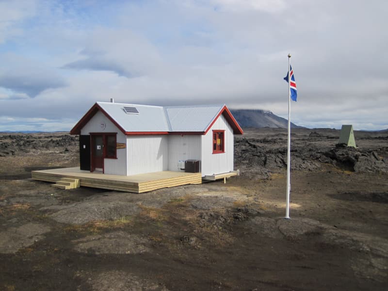
Blágil - Skaftárhreppur
Blágil,The mountain hut in Blágil is located 15 km south of Lakagígar. The hut has sleeping bag facilities for 18 people. There are kitchen and dining facilities and the hut is heated with gas. The toilet is located outside the hut. Outside the hut, there is also a camping area. The hut is open for booking all year round.
Rjúpnavellir
Holta- og Landsveit (vegur/road 26), 851 HellaRjúpnavellir in Rangárþing Ytra is a small and comfortable resort in south of Iceland. It is located only 9 km from the famous volcano - Hekla, about 90 minutes drive from Reykjavík.
At Rjúpnavellir, there are sleeping bag accommodations for 44 people in two comfortable cabins and 3 cottages for 4-8 people each. Our guest have access to free wifi. We also have small camp side.
Staying at Rjúpnavellir is great way to experience Iceland. It is close to the highlands; places like Landmannalaugar, Hrafntinnusker, Veiðivötn and Fjallabak. The cabins are ideally located for those interested in hiking and/or riding tours, enjoying the unspoiled nature or simply travel around. Hiking on the volcano skirts is an exhilarating and unforgettable experience.
GPS POINTS N64° 2' 3.857" W19° 50' 6.233"
Ferðafélag Fljótsdalshéraðs - Húsavík
Víknaslóðir, 720 Borgarfjörður eystriA hut under the auspices of the Fljótsdalshérað Touring Club, situated at Húsavík, the southernmost creek of the so-called Víknaslóðir hiking trail, south of Borgarfjörður Eystri. There is sleeping bag accommodation for 33. The chalet is heated with a lumber stove and there is gas for cooking, as well as a shower and a WC. Camping facilities at hand.
Gas for cooking, wc.
. Accommodation: 33 sleeping bags
. Operating time: Closed and locked during winter, wardens during summer
. Telephone: No telephone
. GPS: N65°23.68-W13°44.42
. Other facilities: Wood stove for heating. Gas stover for cooking. Toilets and shower. Camping place, coal grill (but no coals)
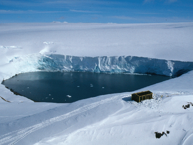
Esjufjöll - The Iceland Glaciological Society
125 Reykjavík,This chalet in Esjufjöll ( Vatnajökull glacier), owned by the Iceland Glaciological Society, provides space for 6 til 12 persons.
It´s location: GPS: N64°12,196 W16°25,463.
Further information: www.jorfi.is
Árbúðir
Myrkholti, Bláskógabyggð 801 Selfoss ,Arbudir is a mountain cabin right beside the Kjölur route on the banks of the river Svartá The cabin has sleeping-bag accommodation for 30 overnight guests. Guests have the use of good cooking facilities, WC and a hot shower. Nice walking tracks along the river. Hvítárnes is a beautiful place by the lake Hvítárvatn that offers stunning views across to the glacier Langjökull.
Álftavötn - Útivist Touring Club
Office: Laugavegur 178, 105 Reykjavík,GPS: N 63°40,559 / V 19°29,014
In Lambaskarðshólar in Skaftártunguafrétt. Accommodates 20 persons, WC.
For further information, please click Álftavötn web page (English).
Básar in Þórsmörk - Útivist Touring Club
Office: Laugavegur 178, 105 Reykjavík,GPS: N 63°40,559 / V 19°29,014
In Goðaland - wc, outdoor grills, camping area and a mountain hut.
Supervisor, tel. +354 563-0114 .
For further information, please click Básar hut (English).
Landmannahellir
Landmannahelli, 851 Hella, 851 HellaA peaceful place in Friðland að fjallabaki (Fjallabak nature reserve) to visit for long and short time. It is especially suitable for families, special groups and in fact for everyone who wants to enjoy the peaceful and mystic mountains. There are many interesting and magnificent places in the area, for example, mount Hekla, Krakatindur, Landmannalaugar, Valagjá, and the ice caves in Reykjadalir and Hrafntinnusker.
Landmannahellir (Gps N 64 03 V 19 14 )is easily accessible for those on riding tours in the mountains, and there are good facilities for horses and tourists. There are 3 horse fences, a stable for 40 horses and enough hay. Sleeping bag accommodation is in 9 different nice cottages for 100 guests in comfortable single and double bunks. The cottages are well heated, with running water, cooking facilities and WC.
At Landmannahellir there is a nice camping site and a site for house vans, camping wagons, a lavatory, an outdoor grill, and possibilities to go trout angling in the magnificent neighbouring lakes.
The camp site at Landmannahellir is by a lawn next to the cottages. The area is for about 50 tents. It is possible to buy fishing license for lakes south of the river Tungnaá at Landmannahellir. Also possible to byu accomodation in eight cottages in Landmannahellir.
The facilities at the campsite are good with a toilet, outdoor barbeque and a shower. The tourist service and accommodation centre is open from middle of June to September 16th.
Rates 2024:
Accommodation in a sleeping bag pr person is ISK 7.900, children from 7-15 years pay 3.950 and free for 6 years and younger.
Camping for adults: ISK 2.000.
Camping for children: Free for 12 years and younger.
Shower: ISK 700.
Áfangi
Húnavatnshreppur, Húnavöllum, 541 BlönduósAt Afangi there is hostel style accommodation for up to 32 people in 8 rooms, each accommodating 4 people. Its possibility to get made-up bed with linen.
We have fully equipped self-catering kitchen facilities and a dining area for the use of overnight quests and groups. In our café you can buy hot meals (please order in advance),breakfast, lunsh, coffe, waffles, cakes, soups and bread. From our shop we can also packed lunches. Cold soft drinks and sweets. Cold icelandic beer.
Áfangi has a hot jacuzzi and shower - the ideal way to relax after a long day´s journey!!
GPS: N65°08,701 W19°44,148
Stable.
Þverbrekknamúli - Iceland Touring Association
Mörkin 6, 108 Reykjavík ,The hut in Þverbrekknamúli accommodates 20 people in sleeping bags. It is equipped with gas stoves, utensils and running water. There are bathrooms in a nearby building. The campground is in the hut area.
Trölli - Ferðafélag Skagfirðinga
550 Sauðárkrókur ,GPS: N65°42,600 W19°53,160
In Tröllabotnar. Primitive facilities.
Hagavatn - Iceland Touring Association
Mörkin 6, 108 Reykjavík ,The small hut near Langjökull glacier accommodates 12 people in sleeping bags at most. There are no cooking facilities on site and no drinkable water can be found near the hut. There is an outhouse near the hut.
Karlsstaðir - Ferðafélag Fjarðamanna
Vöðlavík, Fjarðabyggð, 740 NeskaupstaðurGPS: N65°01,803 W13°40,354
In Vöðlavík . Please contact for information.
seldalur@centrum.is
Strútur - Útivist Touring Club
Office: Laugavegur 178, 105 Reykjavík ,GPS: N63°50,330 W18°58,477
North West of Strútur at Mælifellssandur. Wc.
The camp site Strútur is next to the cabin by the mountain Strútur. The camp site Strútur is an ideal layover between the lake Álftavatn in the east and the canyon Hvannagil in the west. There are many great walking paths close to the camp site and a map is sold in the cabin from the beginning of july until the middle of august.
Goðahnúkar - The Iceland Glaciological Society
125 Reykjavík,The glacier hut at Mt. Goðahnjúkar in Vatnajökull, Iceland´s largest glacier, was erected by the Iceland Glaciological Society in 1979. See GPS orientation below. There is space for 6-12 persons in the hut.
GPS coordinates: 64° 35.484' 15° 28.879'.
For further reference: www.nat.is/Fjallaskalar/skalar_jorfi__godahnukaskali_isl.htm
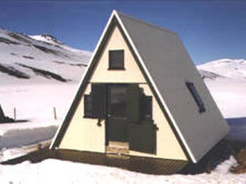
Baldvinsskáli, Fimmvörðuháls - Iceland Touring Association
Mörkin 6, 108 Reykjavík, 861 HvolsvöllurThe hut on the Fimmvörðuháls trail accommodates 16 people in sleeping bags. It is equipped with gas stoves and utensils but no running water. Outside there is a small outhouse with no running water. In good weather, camping around the hut is possible.
Hvanngil - Iceland Touring Association
Mörkin 6, 108 Reykjavík,The hut in Hvanngil on the Laugavegur trail accommodates 60 people in sleeping bags. It is equipped with gas stoves, utensils and running water. There are bathrooms and showers in a nearby building. The campground is in the Lava field, often with good shelter when the weather is bad.